
Warmed by a hot day's sun, a tiny gust of wind comes to life for the first time, rising over a large body of water, carrying some of it along.
Following that rise, it either freezes and falls back down as rain or travels sideways, becoming a nomadic mass of air — a warm air mass. Its job is to create rain wherever it goes. Even so, most warm air masses will not easily give up their water until a more compelling force makes them.
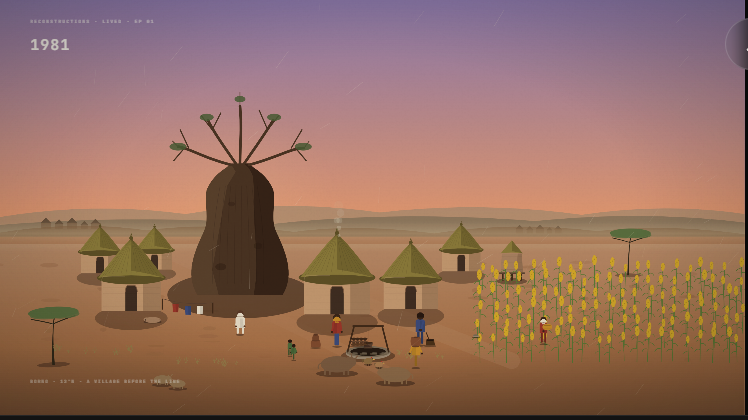
Scientists still cannot say with confidence what warming will finally do to the Sahel. Some models point to more rainy winds. Others point to a breakdown of the monsoon wind system that has long sustained farming across northern Nigeria. This story reconstructs that uncertainty from the ground up: what 45 years of rainfall, temperature, and crop records already show. The result is a harder truth than the rainfall debate suggests. The rains have, for now, returned. But heat brings a food security crisis, among other concerns.
All winds travel toward the middle of the globe through a process called global atmospheric circulation — toward a special destination called the equator. This is where the earth is cut in two halves, and the airspace above this zone is a place worth every wind's long journey. Scientists call it the convergence zone. All winds would love to arrive there, yet not all of them will. That is a good thing for the sake of all life on earth.
Minutes have passed since that tiny gust rose over the ocean. It has now been joined by other warm air masses, transforming into a force for global weather called the warm maritime air mass — the monsoon. They travel together toward the convergence zone, spreading rain in their path.
But if all the air masses are travelling in one direction, what do they converge with?
On a cold night, over a large landscape of dry land, another wind comes to life.
This cold air does not have ambitions to travel the world. It would rather remain idle — cold air sinks while warm air rises, and the cold air mass wants to settle down, preferably in the pockets of low pressure left behind by rising warm air. So despite its preference for stillness, it is pulled along, joining other winds rising from land to form a force large enough to counter the maritime winds coming in from the oceans as both move toward the great zone of convergence.
Unlike the maritime air, this one emerged from continental land. Scientists call it the continental air mass because it is drier and colder. And that difference matters for weather to happen anywhere on Earth.
Battlefronts on the way there
A lone mass of warm air travelling from the Atlantic Ocean through West Africa will encounter cold air waiting near the coastline. The colder air freezes the moisture out of the warm air, turning it into rain clouds that fall. It is why the coast gets the most rain. For the same reason, a warmer world threatens to raise sea levels that could eventually submerge places like Lagos, as heat loads more water into the atmosphere, and the coast bears the first impact.
A front is where the two air masses meet. When the cold air mass is stronger, it freezes the warmer air and produces rain. When the warmer, wetter air is stronger, it pushes through without losing its water, producing clear skies with no rain at all. Fronts are smaller versions of the convergence zone. The areas within the convergence zone itself are the most sensitive to large-scale changes in weather, including global warming.
The Intertropical Convergence Zone
The world's most productive agricultural regions depend on the ITCZ for rain. The convergence zone drives weather across West, Central, and East Africa, often producing two rainy seasons in equatorial regions, including Nigeria, the Central African Republic, Cameroon, Ghana, and the Great Lakes region. It shapes the weather of South America's Amazon basin, Central America, and the monsoon systems of South and Southeast Asia.
Crossing the 2°C threshold
As the world moves toward 1.5°C and 2°C of warming, the zone intensifies. The atmosphere holds about 7 percent more moisture for every degree of warming. This is based on a climate science relationship known as the Clausius-Clapeyron equation. More moisture means more rain in many places. But it also means a more unpredictable redistribution of where that rain falls, breaking seasonal cycles and increasing the risk of both major floods and prolonged dry spells.
As the rising temperature continues to enhance the maritime air mass, it messes with the balance with the continental air in the convergence zone. This is called the Atlantic Meridional Overturning Circulation (AMOC), and is directly related to ocean and land temperature, and the quality of air masses they now produce. Rain winds travel less inland than they used to. Risking the likelihood of it falling short of reaching the Sahel. The IPCC says this slowdown is already happening and will continue.
This presents a complicated future for the Sahel specifically. Scientists say they cannot confidently predict what happens to the West African portion of the convergence zone in a warmer world. According to the IPCC's Sixth Assessment Report, the panel could project a wetter future for many regions as the atmosphere thickens with moisture, "particularly over South and Southeast Asia, East Asia and West Africa, apart from the far west Sahel."
"Apart from the far west Sahel."
Nigeria, along with the Sahel countries like Burkina Faso, Mali, the Niger Republic, and the Lake Chad basin, is all within this contested zone where models break down. Armstrong McKay and colleagues, in one of the most cited climate reassessments of 2022, put it plainly: "The existence of a future tipping threshold for the West African Monsoon and Sahel remains uncertain, as does its sign... we retain the Sahel/WAM as a potential regional impact tipping element (low confidence)."
A 2024 multi-model study by Ben-Yami and colleagues, published in Earth's Future, sharpened this picture. They ran an AMOC collapse experiment across four independent leading climate models. This time, the models agreed. Across 95 percent of the land area studied, all four models pointed in the same direction: less rain. They projected a 29 percent reduction in annual rainfall over the West African Monsoon region, with shorter wet seasons and longer dry seasons.
Monsoons are critical to the agricultural rhythms and water supplies of some of the world's most populous countries. For Nigeria, this is also the region where most grain crops are grown, including sorghum, maize, and millet, major food crops to feed the entire country. A disruption of this leads to a national food crisis.
Millet survives. The others are already failing
Across 232 local government areas in northern Nigeria's states are the regions most exposed to what the changing weather brings. We measured 45 years of rainfall records against the crop requirements for the three staple grains. The temperature stress thresholds for each crop were derived empirically from the observed relationship between ERA5 temperature data and crop viability outcomes across that same period. The crop water parameters follow FAO Paper 56 standards.
Millet is the toughest of the three. It is the drought-resistant crop that farmers fall back on when the farming calendar stops working. The current climate puts millet just 0.12 degrees Celsius above its own empirical stress threshold. At the current rate of warming, millet reaches that line somewhere around 2041.
The other crops have already crossed it.
For every degree Celsius of additional warmth, maize viability in northern Nigeria drops by approximately 12 percent. That figure comes from 45 years of observed data on what actually happened between 1981 and 2025. When we identified the temperature level at which maize shifted from struggling to consistently failing across the region, and matched it against the observed temperature record, the crossing point was around the year 2001. Maize has been farming above its heat stress threshold for roughly two decades.
In Borno and Yobe — the driest and hottest states in the study area, about 25 local government areas cannot reliably grow maize under the current observed climate, and 12 cannot reliably grow sorghum. This is the 45-year historical record showing that the food system in northeastern Nigeria is not waiting for a future crisis. It is already in one.
Sorghum crossed its own heat stress threshold sometime in the mid-1980s.
Meanwhile, the rainfall picture tells a different story than the one most people expect. Since 1981, the July-August-September monsoon over northern Nigeria has been delivering more rainfall every year — approximately 3 millimetres more annually on average. Over the full 45-year record, northern Nigeria now receives roughly 25 percent more rain than it did at the start. This is consistent with what ecologists have been documenting since the 2000s: a partial recovery of the Sahel after the major droughts of the 1970s and 1980s. Greenhouse warming, for now, is winning the rainfall argument, threatening climate and food crises.
But rainfall alone is not what is failing northern Nigeria's food system. The problem is thermal. The rains came back due to the rising heat. The same mechanism is equally likely to cause drought. The Sahel is at the centre of this crisis.
All data, code, and methodology can be found at mansirmuhammed.com. And in the project’s GitHub repository.**